


34 Baltimore
We arrived in the middle of the big party.
The Volvo 70s, which are racing around the world, just finished leg 5 (Rio to Baltimore). The city is putting on a “Waterside festival’ in their honor. The Hoopla is in full swing. You can gawk at the boats (carbon fiber hull, canting keel, sails like billboards). You can buy souvenir regalia. There is a tall ship from Brazil you can get on. And there is the crab cake eating contest. This contest is not a frivolous affair. It is regulated by the International Federation for Competitive Eating and there will be eleven world class competitors.
Tucked away in a corner, something we had to see.
NOAA’s “Thomas Jefferson” was resurveying in Maine when it was called to New Orleans to see what Katrina had done to the tanker channels. It is now back up north, and is here for a PR day as part of this Waterfront festival”.
The members of the NOAA crew that showed us around are a young and bright. They really enjoy what they are doing. NOAA is not part of the military (like the coastguard or navy) and they are all very unstuffy and relaxed.
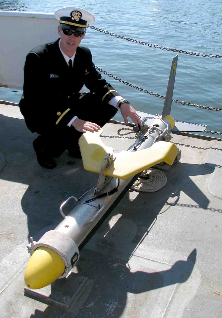
The ship has a multi-beam sonar that plots the contours of the seafloor on either side for each increment in the ships GPS position. Also it tows a ‘side scan sonar’ which looks like a torpedo (they call it “The Fish”) that plots a continuous image of the bottom as detailed as an ultrasound of your baby. (They have this neat picture of a whale that swam under the boat). The two launches which the ship carries have identical equipment so they can plot three lines at once.
At the end of each shift, terabytes of data are dumped into the ships computer. And out comes a chart? Not quite. The ship rolls in the swells. You have to correct for that with a gyroscopic gadget that plots the ‘moving vessel profile.’ The speed of sound varies with salinity and temperature. You have to measure those. Then there are the glitches from fish or bubbles. The scientific crew goes through the data frame by frame rejecting artifacts and distinguishing whales from rocks. This review is completed overnight so that the ship can return to the next day to areas of doubt.
When they are happy with the data they fire them off to the NOAA shore station and a map is published on the NOAA web site. Anyone can look at it for free.
Katrina had shoved a huge sandbank in to the tanker channel. Good job they did not let any tankers through. A couple of days after the NOAA survey they started dredging.
posted by Peter and Moya "Golden eye" @ 7:58 AM
![]()

0 Comments:
Post a Comment
<< Home